
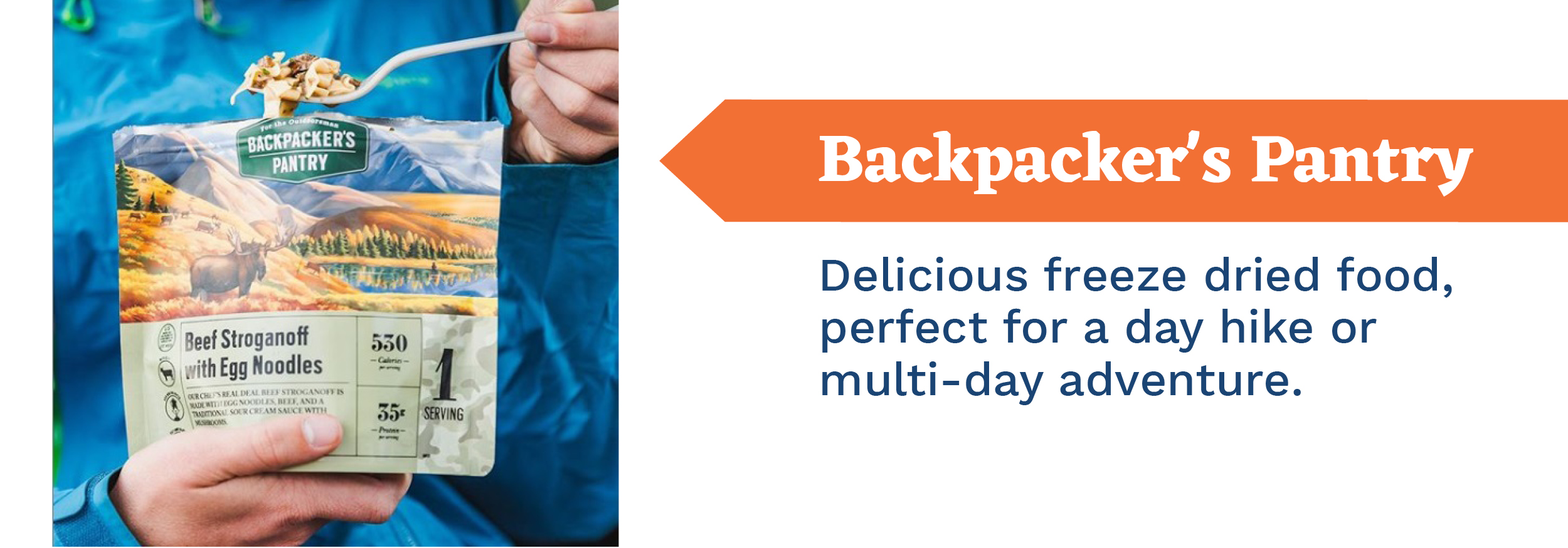
In this post, we share some of our favorite gear essentials for fall hiking and provide recommendations for both hiking and driving along the North Shore of Lake Superior during this glorious time of year.


At just 1.4 miles one way, the hike from Highway 1 to the Fantasia Overlook is a short hike with great views of Lake Superior and Wolf Lake, a picturesque lake formed in a deep depression. The section of the trail is located just north of Tettegouche State Park. The trail includes some ascents, descents and switchbacks, but offers excellent overlooks that make it worth the trek.
TO GET THERE:
Take Highway 61 to milemarker 59. Turn left on Highway 1, and the trail parking lot will be less than a mile away.
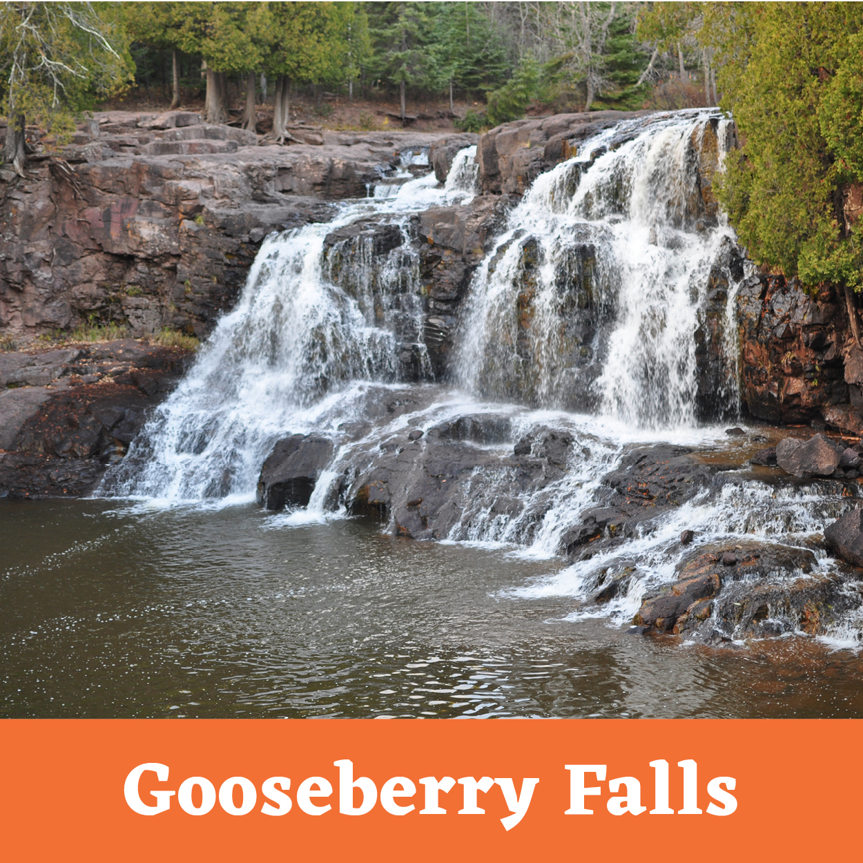
Gooseberry Falls State Park: Fifth Falls. This segment covers the mandatory Fifth Falls Trail, a healthy distance of a loop that’s full of native beauty, Gooseberry River and its signature Fifth Falls waterfall. Even on the busiest of days, this trail is your best bet for avoiding tourists.
TO GET THERE:
Park at Gooseberry Falls Visitor Center, follow the signs for the Upper Falls trail which starts out paved and goes under Hwy 61. There are maps along the way and you’ll know when you’ve arrived at the fifth falls when you come to a bridge crossing over the river.
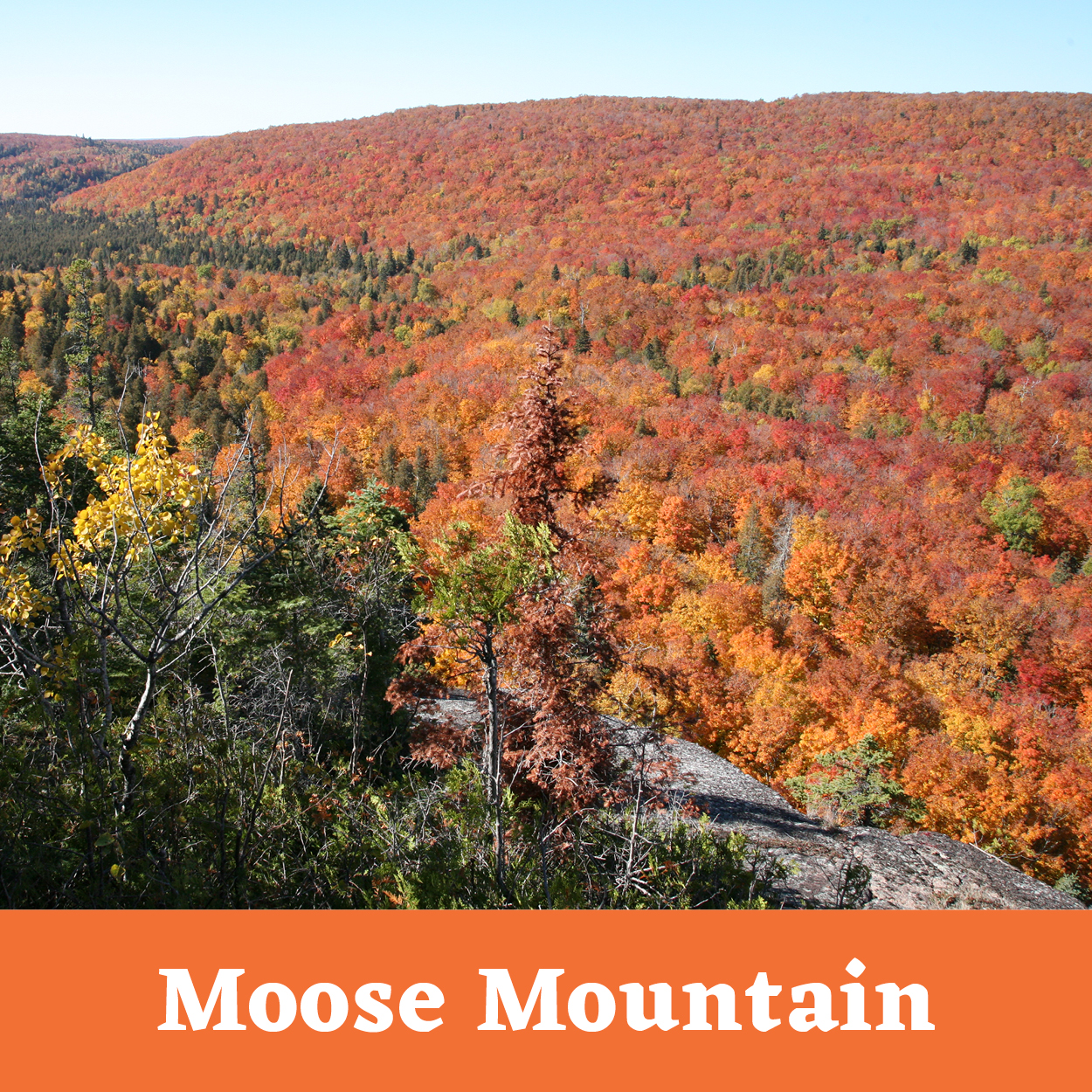
Lutsen Mountains features several miles of hiking trails, including hiking along the Superior Hiking Trail. Combine a hike with a ride on the Summit Express for easy access to mountaintop trailheads that lead you through wildflower meadows and deep forests, past waterfalls, wildlife, and spectacular mountain overlooks. Ride the gondola to the Moose Mountain summit, and return to the base area via the spur trail and the SHT on a lovely 4.5-mile loop.
TO GET THERE:
Click here to view a map of Moose Mountain hiking trails and the Summit Express gondola.
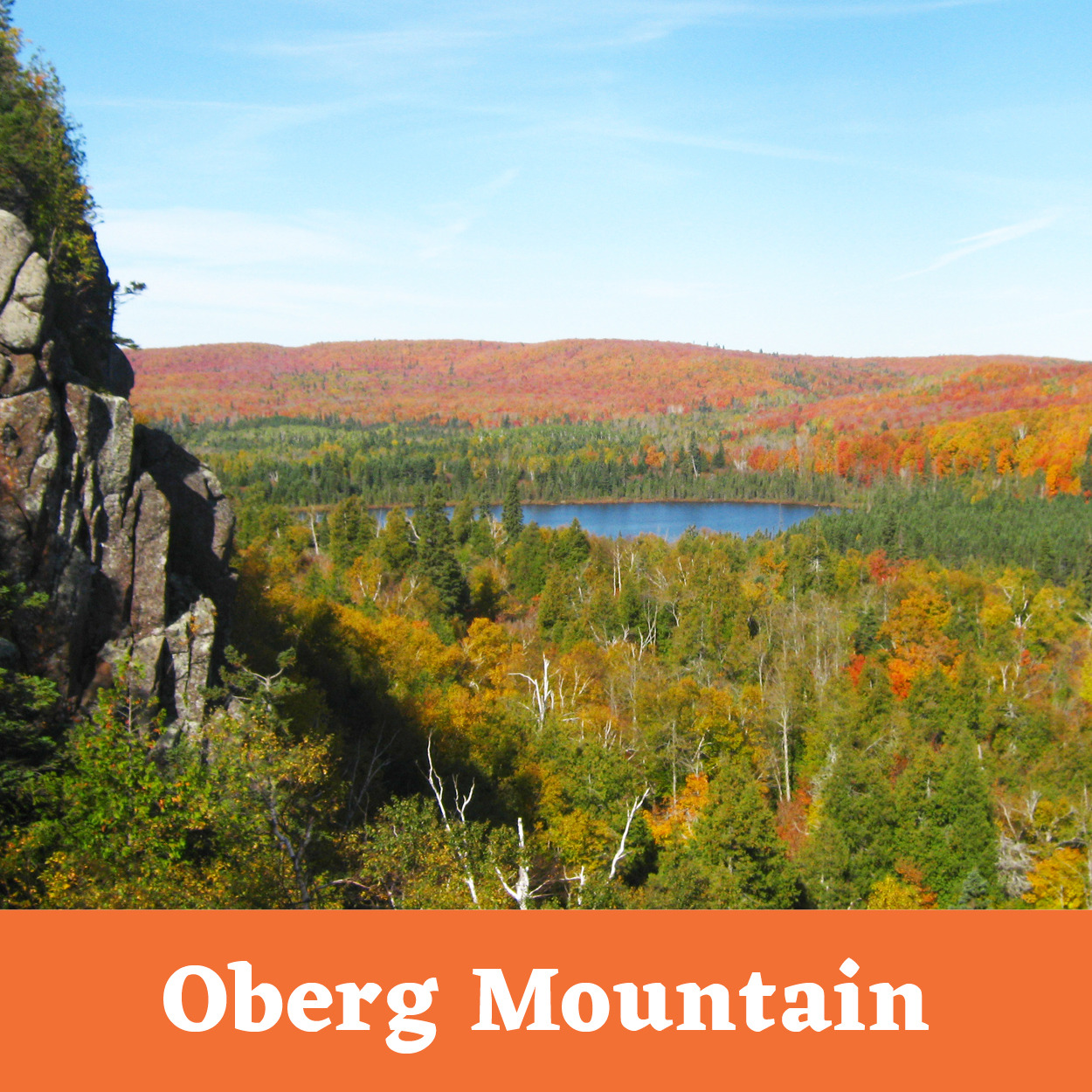
This 1.8 mile loop trail is covered in maple trees that offer brilliant red and orange leaves in the fall. In total, the loop has eight different overlook spots, providing a 360 degree view of the North Shore, plus Carlton Peak in the distance. The loop’s overlooks are developed for added safety, and one stop has a picnic table.
TO GET THERE:
From Highway 61 turn at Forest Road 336. Parking is about two miles on 336. The trail is north of Tofte and south of the Lutsen Ski Area.
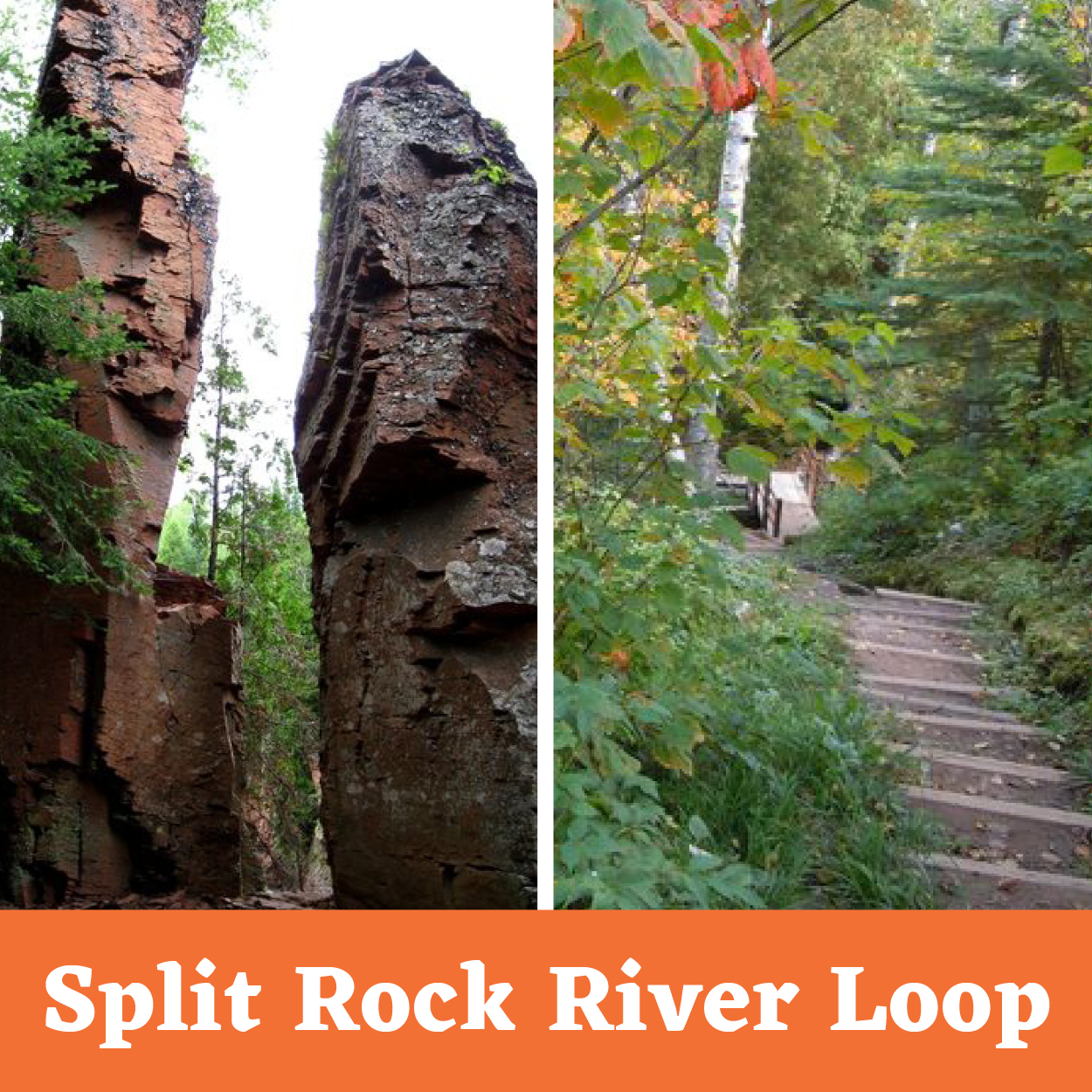
The walk up the rocky west side of the Split Rock River begins with the rivers estuary and, after crossing Strand Creek and its wonderful grotto, there are the rivers gorges, falls, rapids, and cliffs. These are mostly formed from the Split Rock Rhyolite with the two most impressive rock features being the Two Towers and the Beehive.
TO GET THERE:
From the Split Rock wayside parking area, follow the spur trail for 0.5 mile to the junction with the SHT. Follow the SHT up the river’s west side passing two campsites along the way. At 2.6 miles, normally this is where you would cross over the river on a bridge. However, the bridge is currently out and the hike is an out and back.
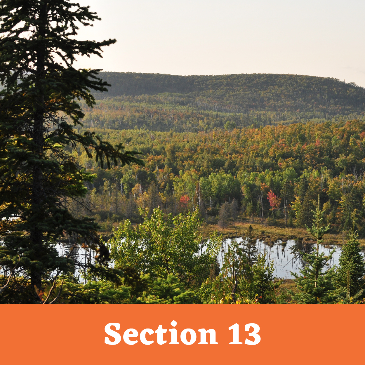
While the hike to the Section 13 cliffs is only one mile, the hike is pretty up and down until you get up to the cliffs with an elevation gain of 450 ft. It would be hard to do with small kids or older relatives. Once you reach the cliffs you are rewarded with panoramic views of the Sawmill Creek and Baptism River valleys.
TO GET THERE:
From Duluth, follow Highway 61 until you reach mile marker 65. Shortly after this you will turn left on Lake County Road 6. Continue for just over 2 miles and the trailhead parking lot will be on your right. There is a sign with mileage to nearby backpacking campsites if you want to stay and explore some more.

There are so many maples and maple syrup company, Caribou Cream, is located at the top of the hill.
View on Google Maps

Beautiful maples create a tunnel of color over the road.
View on Google Maps


Stop and read how Heartbreak Ridge got its name. Or if you’re biking this section, it will become apparent.
Skyline Parkway runs the entire length of Duluth and offers a variety of scenic vistas.

Hwy 1 to Lax Lake Road is a beautiful drive that will take you behind Tettegouche State Park into Silver Bay. View on Google Maps
Recent Comments